Digital Renderings
Bring ideas to life. Visualize. Design. Inspire.
At Shamrock+, we create high-quality digital renderings that bring spaces, ideas, and designs to life. Our digital renderings combine precision, creativity, and advanced technology to deliver powerful visualizations for every stage of a project.
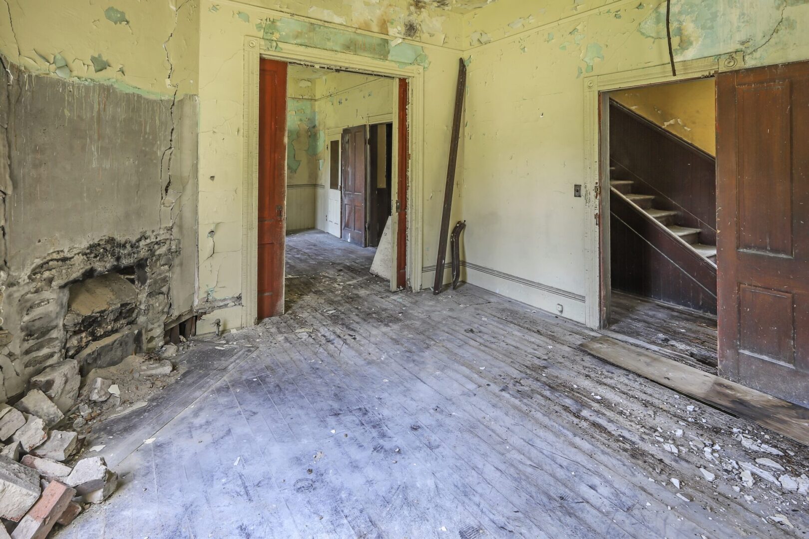
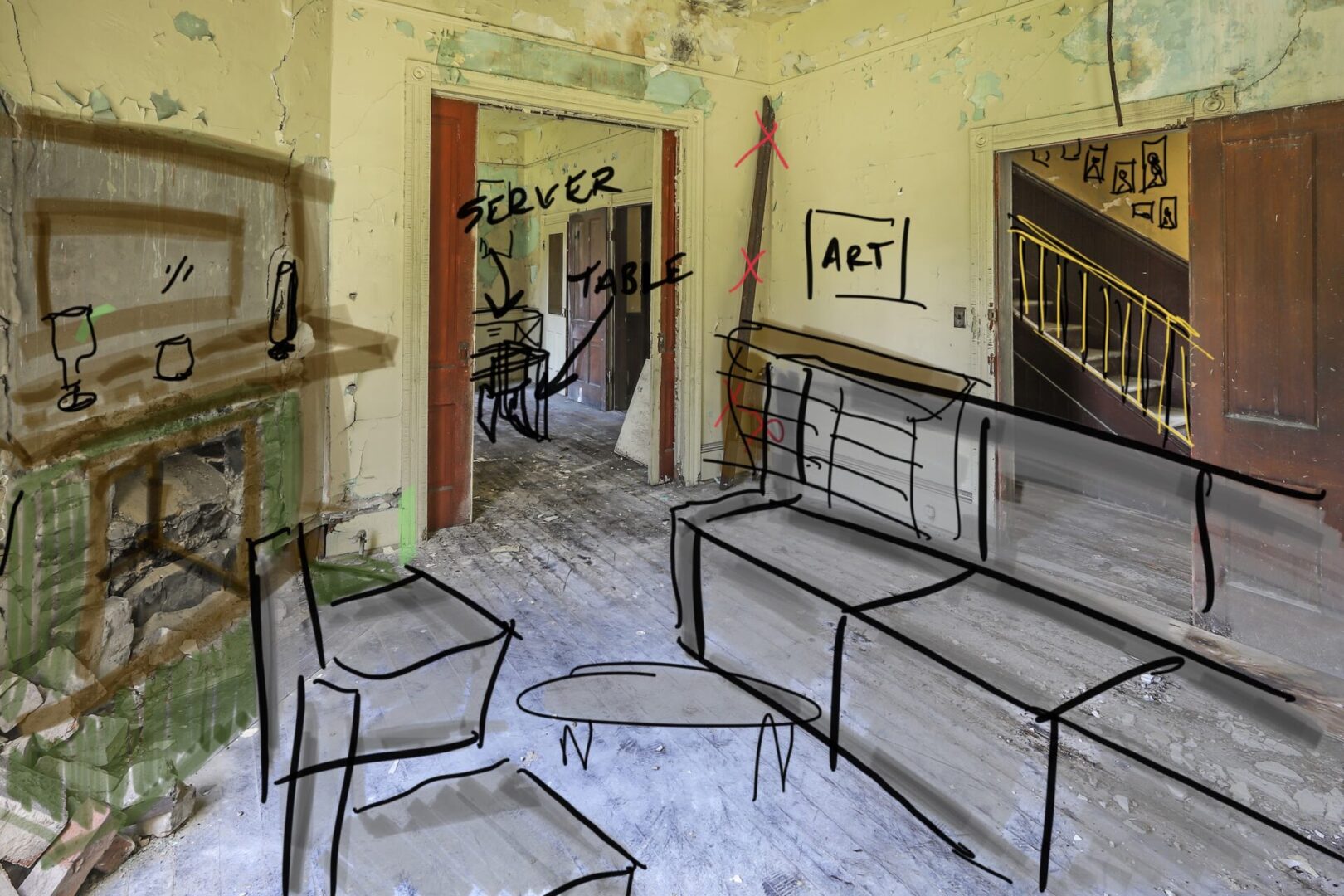
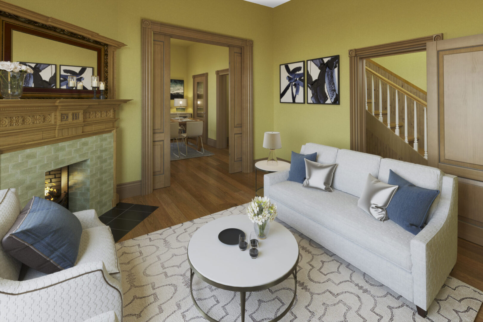
We use real-world data, site photography, and 3D modeling to build accurate, photorealistic visuals. These renderings show how a space will look after construction, renovation, or design updates. As a result, clients, investors, and buyers can explore the final vision before work even begins.

Virtual Renovations
Simulate potential renovations and alterations to existing properties in a virtual environment, allowing clients to explore design options and make informed decisions before committing to costly construction work.
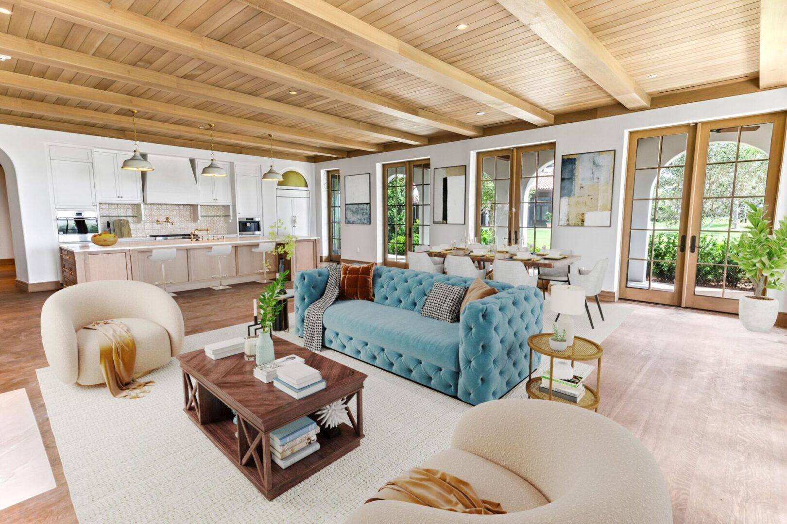
Virtual Staging
Digitally furnish and decorate properties to enhance their appeal and marketability, enabling clients to visualize spaces with different styles and layouts, ultimately speeding up the sales or leasing process.
Check out more information about Shamrock+ Digital Renderings in our Real Estate Services.
Why Digital Renderings Matter
Perfect for architects, real estate agents, developers, and property owners: they help you communicate ideas clearly, eliminate guesswork, and build trust with your audience.
Moreover, our creations support marketing, pre-sales, planning, and client presentations. Whether you are promoting a new listing, pitching a renovation, or finalizing a development plan, Shamrock+ helps you tell the full story visually.
Fast, Accurate, and Impactful Results
Additionally, we focus on speed, accuracy, and attention to detail. Our team uses cutting-edge software and rendering techniques to ensure every image is both beautiful and technically precise.
Using digital renderings saves time, reduces costs, and improves decision-making. It helps clients visualize possibilities without the need for physical models, costly staging, or lengthy site visits.
Shamrock+ Digital Renderings
Envision with precision. Communicate with impact. Build with confidence.