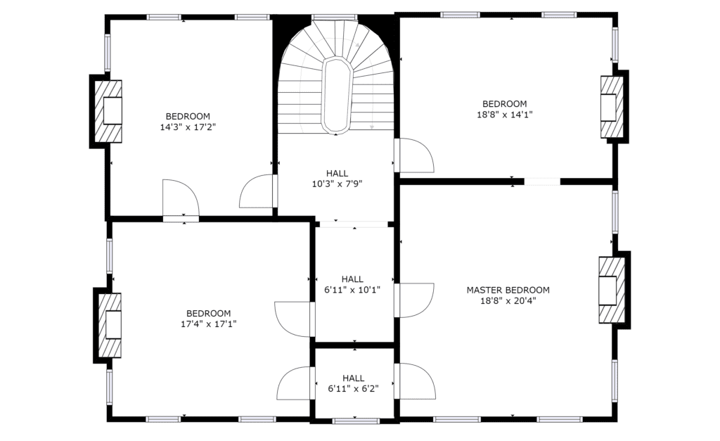
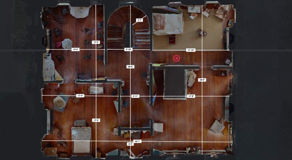
As-Built Revit Models & Floor Plans, Elevations, Site Plans
Accurate drawings. Reliable data. Built on reality.
Professional As-Built Modeling and CAD Exports You Can Trust
At Shamrock+, we specialize in creating highly accurate as-built Revit models and CAD exports for architecture, engineering, and construction teams. Our process starts with precise 3D laser scanning of the existing structure. From there, we convert real-world conditions into usable 2D and 3D drawings, digital twins, and Revit models.
These deliverables serve as the foundation for design documentation, permitting, and construction. Whether you're remodeling, restoring, or planning a new addition, we give you the exact data you need—no guesswork, no gaps, and no surprises.
Why As-Built Revit Modeling Matters
When a project begins without accurate records of the existing space, mistakes can happen. Outdated plans, missing measurements, or manual errors lead to change orders, delays, and higher costs. That’s why as-built documentation is critical—especially in adaptive reuse, restoration, or renovation projects.
Our professional Revit modeling services support architects, engineers, and contractors at every stage. We tailor models to your preferred LOD (Level of Detail) and include the elements most important to your design or construction scope.
Whether you're developing permit sets, generating construction documents, or modeling MEP systems, we deliver clean, usable Revit files that integrate directly with your workflow.
Deliverables Built to Your Specs
At Shamrock+, we understand that every project is different. That’s why our services are flexible and fully customizable. Deliverables can include:
2D CAD Drawings
Clean, layered DWG or DXF files ready for editing.
3D Revit Models
LOD 100 to LOD 350 options, complete with families and parameters.
Digital Twins
Full 3D environments with visualization tools and annotation options.
Interactive Virtual Tours
360° site walkthroughs for remote collaboration and progress tracking.
Point Clouds & Contour Files
For advanced BIM and civil workflows.
From Laser Scan to Digital Twin: A Precise Process
Every model we deliver starts with high-resolution 3D laser scanning. We use industry-leading LiDAR technology to scan interior and exterior spaces, structural elements, and complex layouts. This produces a dense, accurate point cloud—a 3D snapshot of the real-world conditions.
This process ensures we capture every detail, from ceiling heights to wall thicknesses, door swings, window placements, and mechanical systems. Everything is exact. No assumptions. No redraws.
CAD Exports That Fit Your Platform
Need editable 2D files? Shamrock+ provides clean CAD exports. Our professional CAD floor plan services include linework for:
-
Walls, doors, windows
-
Room tags and dimensions
-
Levels and gridlines
-
Structural elements
-
Equipment and fixtures
-
Keynotes and annotations
Every export is tailored to your CAD standards and project templates. We reduce your in-house drafting time by delivering ready-to-use files straight from the scan.
Historic Floor Plan Documentation
In a city like Savannah, historical accuracy matters. That’s why Shamrock+ offers dedicated services for historic Savannah floor plan documentation. We’ve worked on churches, civic buildings, and 19th-century homes—each with unique design challenges and preservation needs.
Using non-invasive scanning and modeling, we capture the structure without damaging materials or finishes. Our architectural as-built digital twin modeling preserves the space visually and structurally. This is ideal for:
-
Landmark preservation
-
Grant funding support
-
Adaptive reuse planning
-
Public records and historical archives
We provide data that satisfies both historical accuracy and modern design requirements.
A Seamless Partner for Your AEC Projects
Shamrock+ has supported a wide range of clients—from local architects and real estate developers to national engineering firms and historic preservation specialists. No matter the size or complexity, we deliver reliable results you can build on.
We’re based in Savannah but serve clients throughout Georgia, South Carolina, North Carolina, and beyond. Our clients rely on us for precise, fast, and affordable modeling services that reduce risk and improve project delivery.
Let us help you eliminate rework, plan with certainty, and move forward faster.
Contact us today to schedule your scan or request a custom quote.
Shamrock+ As-Built Drawing Services
Measure. Model. Document. With accuracy that builds trust.


