Precision Measurement Collection
Measure with confidence. Capture every detail. Build without guesswork.
Accurate Laser-Gathered Measurements for AEC Projects
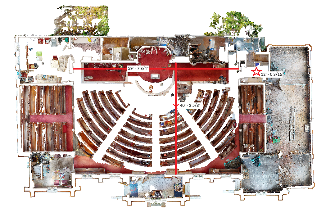
Shamrock+ delivers high-quality precision measurement services using advanced 3D laser scanning technology. We collect exact measurements from real-world environments and convert that data into usable formats for architects, engineers, and construction teams. Whether you need floor-to-ceiling dimensions or surface-to-surface spacing, our scans ensure the data collection is accurate, fast, and complete.
We use high-resolution LiDAR scanners to capture millions of measurement points. This allows us to record the shape, size, and position of every feature—indoors and out. As a result, you get exact data measurements that reflect real conditions. These measurements support site planning, facility upgrades, structural assessments, and renovation workflows.
Reliable Data You Can Build On
With Shamrock+, you don’t have to rely on outdated blueprints or hand-measured sketches. Our scanners gather data at a level of accuracy that tape measures and traditional tools can’t match. We create 3D point clouds, digital twins, and drawings that are measurable from any angle.
We also export that data into CAD, Revit, and BIM platforms. This gives your team the ability to plan with accurate laser gathered measurements—reducing errors, cutting costs, and speeding up project timelines.

Applications Across Every Phase
Our precision measurement collection services are ideal for:
-
Renovation and retrofit planning
-
Clash detection and design validation
-
Site layout and structural review
-
Facility management and asset tracking
From concept to closeout, our data ensures you’re working with facts—not estimates. Contact Shamrock+ to schedule a scan or request a quote today.
Shamrock+ Precision Measurement Collection
Capture exact data. Plan with confidence. Deliver with precision.
