Tag: site plan

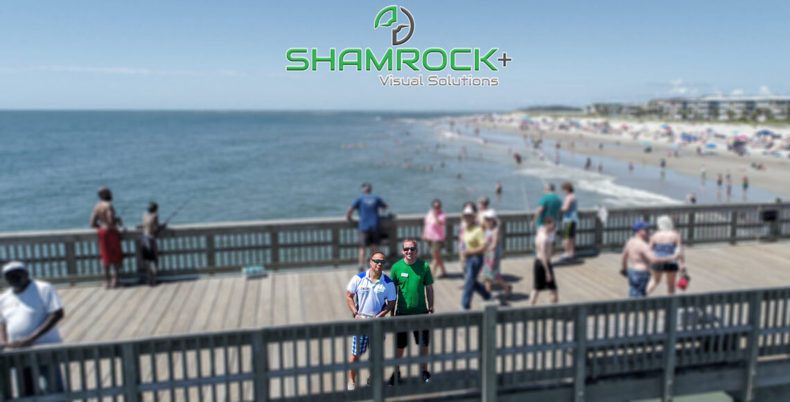
Shamrock+ Celebrates its 5th Anniversary

Shamrock+ Co-founders: Jim Lee and Ryan Murphy (photo taken in 2017)

Five years ago this week, Jim Lee and Ryan Murphy had a vision that Savannah would not only be a center for culture and creativity but could also be a hub for innovation and technology.  The pair went to work on bringing new cutting-edge services to the area as Shamrock Drones.  At first, the company was centered solely on how utilizing drones in Savannah could influence different businesses.  In those days, it was more of a hobby as we learned the ropes of building a technology business as professional photographers.

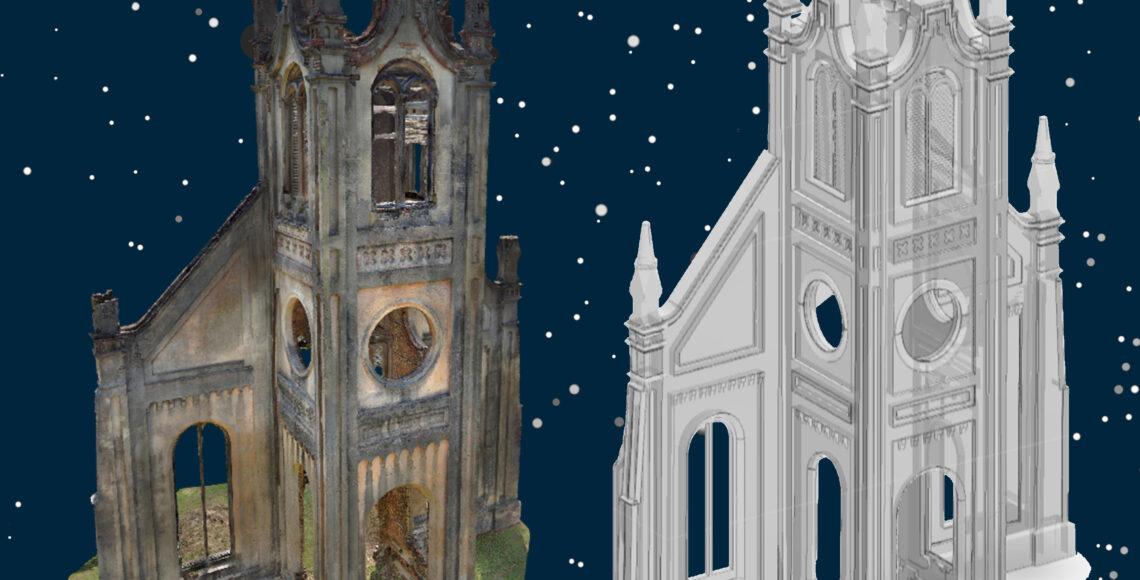
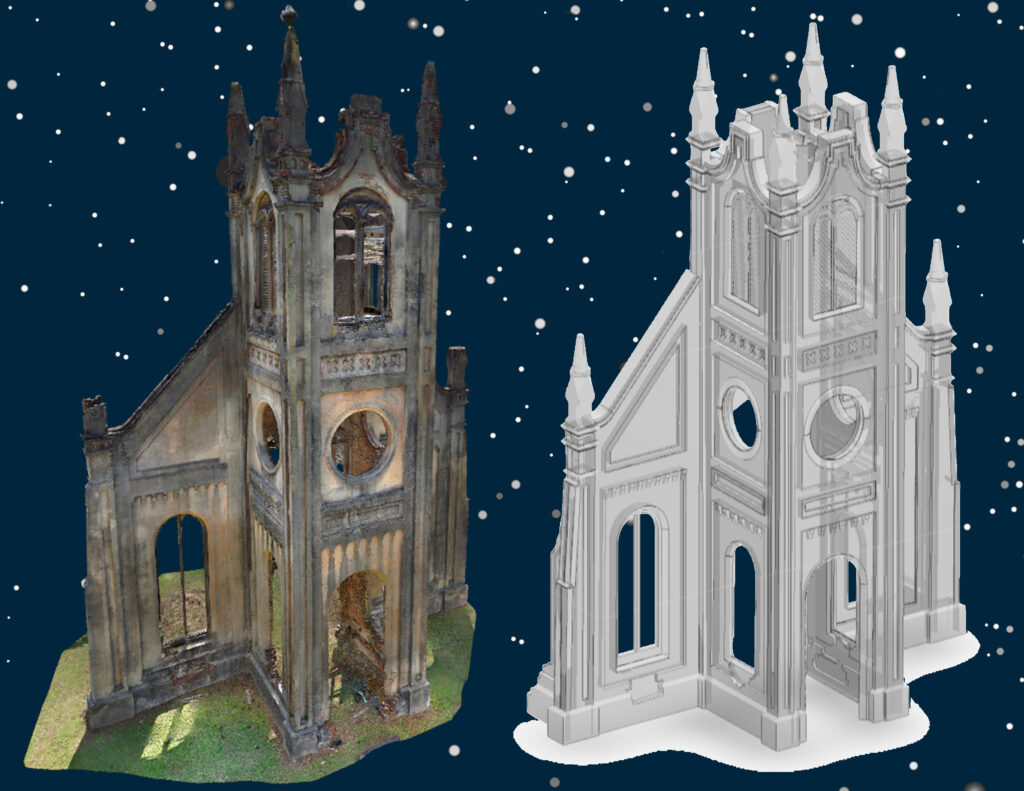
The founders quickly realized that if this venture were to survive, one of them would have to make the effort a full-time commitment.  Ryan was the first to take the risk and was able to use his knowledge and experience as a licensed architect to introduce new services for the architectural community.  As the technical services evolved, so did the business into visual data capture and creating 360° / 3D virtual models.  We became more than just Shamrock Drones, we are Shamrock…Plus so much more.

Meeting the Right People

Today, we have a solid foundation with local and regional professional organizations.  We are proud members of the American Institute of ArchitectsSavannah Chapter, National Association of Women in ConstructionCoastal Georgia #380, Society of American Military Engineers, and Savannah Chamber of Commerce

The Shamrock Plus team are also active members in our local community by strengthening our partnerships with the Savannah Design Collaborative, Historic Savannah Foundation, Savannah Technical College, and the Savannah College of Art and Design

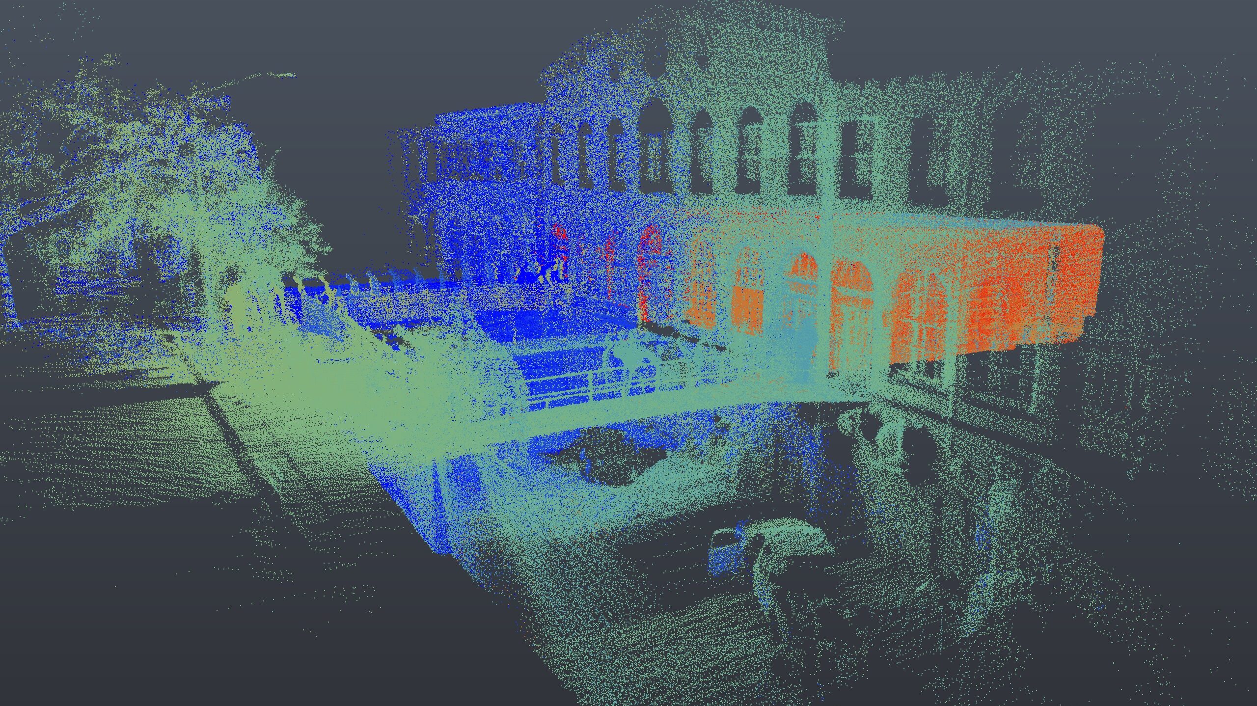
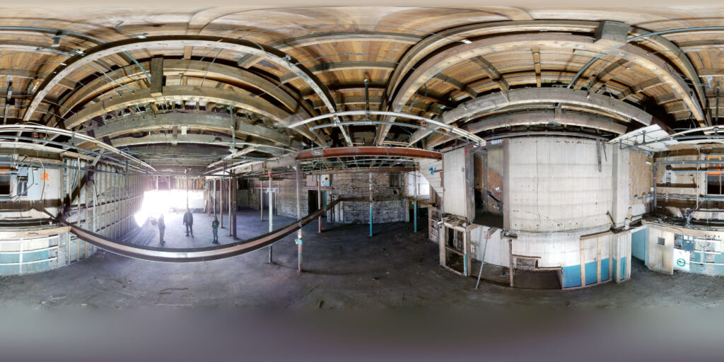
Our team has also grown from a team of two, to an award-winning ensemble cast of designers, creators, and digitizers, with backgrounds in architecture, photography, videography, technology, military service, and good ol’ southern hospitality.  Every day, our team members head out to provide professional still and aerial photography, 3D lidar scans, construction progress documentation, real estate photography, videography, scan-to-BIM, and much more for our clients.

Thank You

On behalf of our entire team, we would like to thank our clients, friends, families, and strategic partners.  Thank you for letting us be a part of your data collection and delivery teams.  We could not have made it these exciting 5 years without you.  This St. Patrick’s Day, stop in and celebrate with our team at our Downtown office.  Cheers!


Connect With Shamrock+

Call today to get started on your next project with Shamrock+. We offer free, no-obligation consultations for every sized project. Click or call today.

Digital Twin Reality Capture by Shamrock+

Digital Twin: 3D Reality Capture

Digital Twin Reality Capture by Shamrock+

Digital Twin

Shamrock+ has captured hundreds of houses, businesses, and other structures in our history. Since learning the skills in our Real Estate Virtual Tours offerings, we’ve adapted the process to suit the needs of our Architecture, Engineering, and Construction (AEC) Clients. The virtual tour is now a tool toward the digital twin, and when combined with our advanced equipment and collection techniques, there’s nothing out of reach. Our equipment is state-of-the-art, meaning we can produce 3D models more accurately and more quickly than even an experienced tape measure-wielding team.

Benefits of Creating A Digital Twin

  • Reality Capture – snapshot-in-time virtual environment documentation
  • High Resolution 360° Photos – HDR photography provides true color rendering
  • Interactive Virtual Tour – 3D scan shows every visible feature with unlimited 360° views
  • Floor Plans – high-accuracy floor plans, generated very quickly
  • CAD / BIM Conversion – 3D point cloud conversion to formats for use by AEC professionals

From Pencil & Paper to 3D Scan

Digital Twin wasn’t even a concept when I was going through architecture school. I bet nearly every Architect has a story from college of a summer they spent capturing as-built dimensions in a dark, damp, dusty old structure. Back in my day, we would use a tape measure and a good ol’ pencil and paper to get dimensions. That right, even before laser measuring tools were a thing. Those handwritten lines and notes would turn into a floor plan, and the floor plan would eventually get us to where we needed to go: renovation drawings. The problem with that tactic was the inevitability that the walls were never straight, so the dimensions never closed the loop, and our drawings -and our project- was plagued from the start. Those days, my friends, are over!

Now, a few hours with a 3D scanner can replace days or weeks of inaccurate dimensioning. The 3D scanner gives us the answers, proves the walls aren’t straight or plumb, and we get to our renovations drawings faster. But we don’t stop at the walls! We now have hundreds of inspection photos and literally millions of data points, identifying everything the camera can see. That includes the geometry inside, outside, above, and below. This 3D data collection is becoming increasingly known as a ‘digital twin.’ Data like this…coming soon to the metaverse near you!

Digital Twin Lidar Scan by Shamrock+

Right Team, Right Technology

We already mentioned that our Shamrock+ President is an Architect, but having the right team and equipment is helpful too. Our data capturers are also professional photographers, so our team knows that quality matters most. We use special cameras, Light Detection and Ranging (LiDAR) sensors, FLIR, drones, and occasionally a forehead flashlight to capture the 3D data for our Clients. Our FAA-certified Remote (Drone) Pilots capture the out of reach places, reducing the need for scaffolding or bucket lifts to inspect areas.

Accuracy is the name of this game. Our team focuses on capturing a high-quality 3D scan to meet the budget and urgency of our Clients. We can fine-tune the number of data points we collect, so that we don’t over- or under- do it when it comes time to analyze the data.

AEC Services

In addition to creating digital twins, Shamrock+ performs a wide array of services for the Architecture, Engineering, & Construction (AEC) industry, including:

  • Construction Progress Documentation
  • 3D Laser and LiDAR Scanning
  • Photogrammetry and Land Mapping / Surveying
  • Thermal FLIR Inspections
  • Scan-to-BIM Conversions
  • Architectural Photography & Videography
  • Marketing & Social Media Photography
  • Drone Services
  • and More+
360° Lidar Photo by Shamrock+

In Closing

Originally, we began as a Savannah drone company in 2017 (ever heard for Shamrock Drones‽), and while our strength is in our attention to customer service, our passion is in technology and innovation. We offer these benefits to architects, engineers, contractors, along with all types of Clients looking to improve their visual solutions.

Create A Digital Twin with Shamrock+

Call today to get started on your next Reality Capture project with Shamrock+. We offer free, no-obligation consultations for every sized project. Click or call today.

Get a free quote for your project. Click here.